
In this article, you will learn how to create custom topographic maps from anywhere on Earth.
There are many online tools when it comes to generating an STL file from real-life terrain. I personally favour the tool called TouchTerrain since it is the most accurate free option I could find.
https://touchterrain.geol.iastate.edu/
To get started, head to their website linked above. If the link is not working, google touchterrain and try to find a website that looks like this.

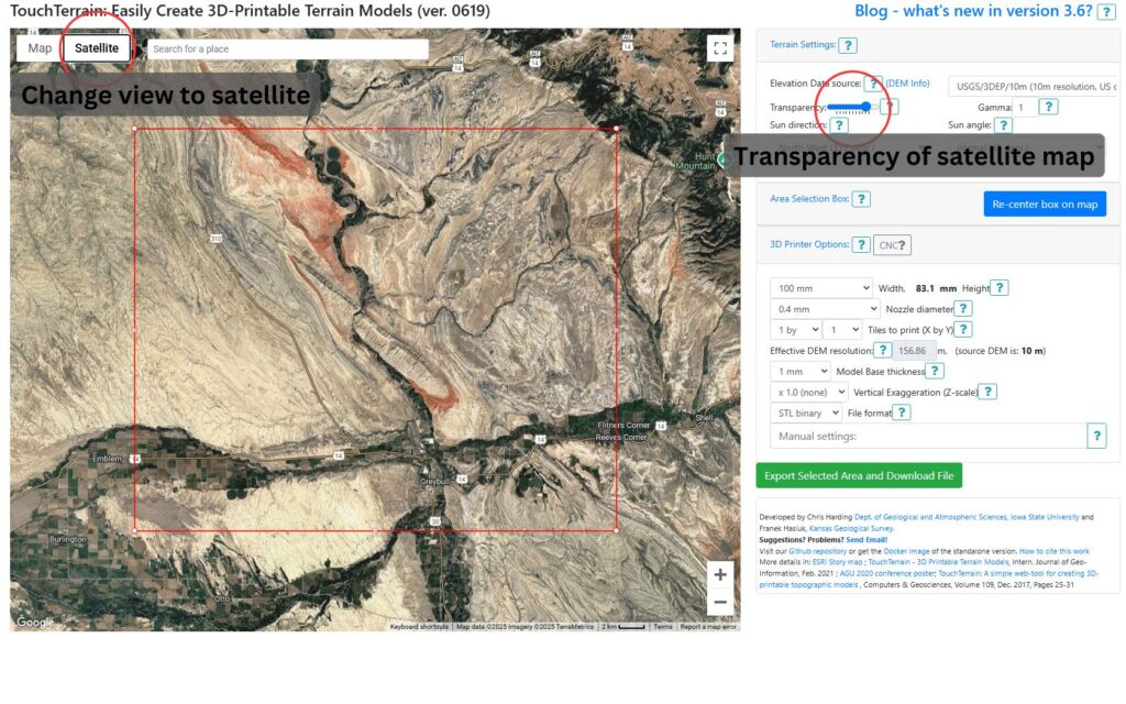
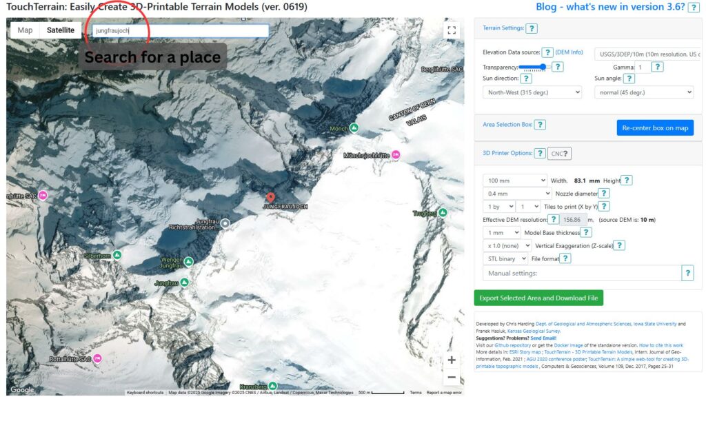
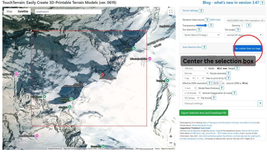
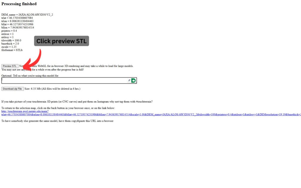
Now you can follow the steps shown on the following pictures.
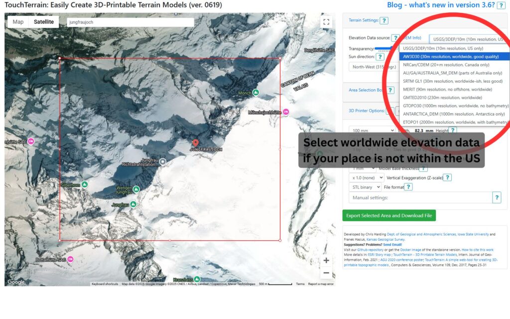
You can play around with the elevation data source if you want. Different models have different quality. For the US, always use the first option, and for other locations, often the second model works best.
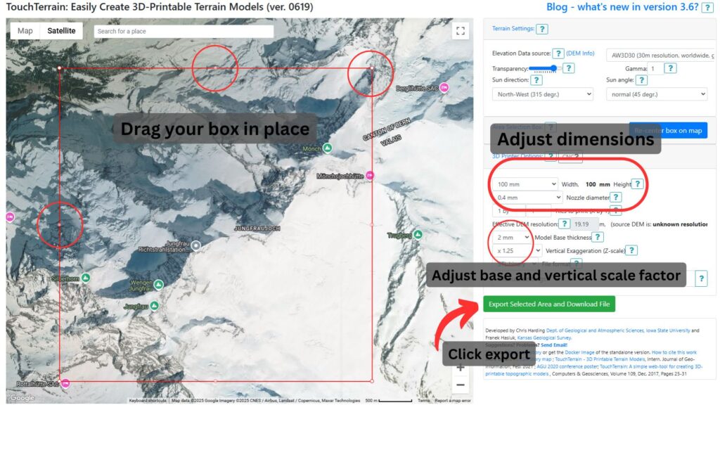
The base thickness is the thickness of the 3D model until the topographic map starts. 2 mm are strong enough for most models, except your map is extremely flat.
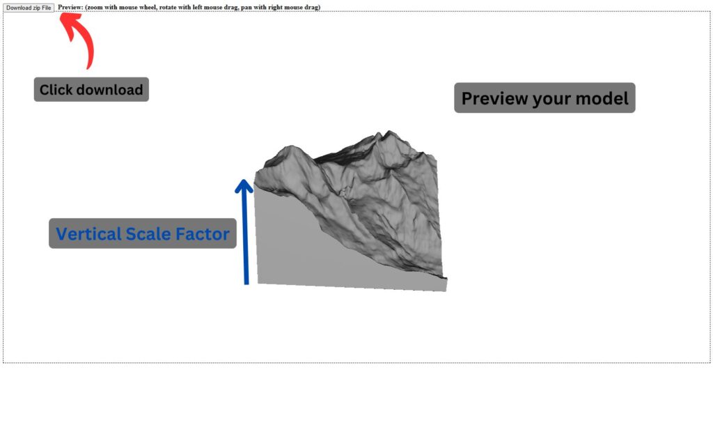
Vertical scale factor is how much your map is stretched in the z direction. Often 1.25x looks a bit better than the original 1x factor. On the last picture you can find a visual explanation.
Check out our example model on MakerWorld: https://makerworld.com/en/models/695163?from=search#profileId-624077